PACific MANgrove Monitoring Network (PACMAN)
Long-term monitoring of Pacific mangroves to understand — and respond to — sea-level rise.
Long-term monitoring of Pacific mangroves to understand — and respond to — sea-level rise.
Mangroves protect Pacific coasts, store carbon, and support livelihoods. But accelerating sea-level rise threatens their survival. PACMAN helps identify which forests can keep pace — and which are most at risk.
Work with communities to measure permanent plots and rSETs.
Track patterns across Palau and the Federated States of Micronesia.
Provide data that supports local and national planning.
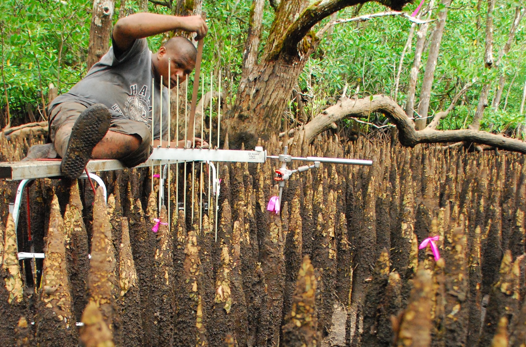
We install rSET benchmarks and remeasure forest floor elevation to see if mangroves are keeping pace with sea-level rise. Pairing rSET with LiDAR/structure scans and sediment cores provides early warning where elevation gains are slowing — or reversing.
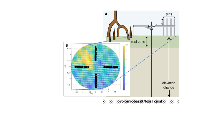
A. Rod Surface Elevation Table (rSET) benchmarks allow repeat, high-precision measurements of forest floor elevation. B. Example scan of the forest floor, showing how LiDAR scans can reveal spatial patterns that traditional pins may miss.
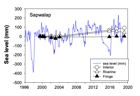
Example of how plot measurements can be translated into site-level trends across mangrove zones (e.g., interior vs. riverine vs. fringe) to interpret whether areas are keeping pace with sea-level rise.
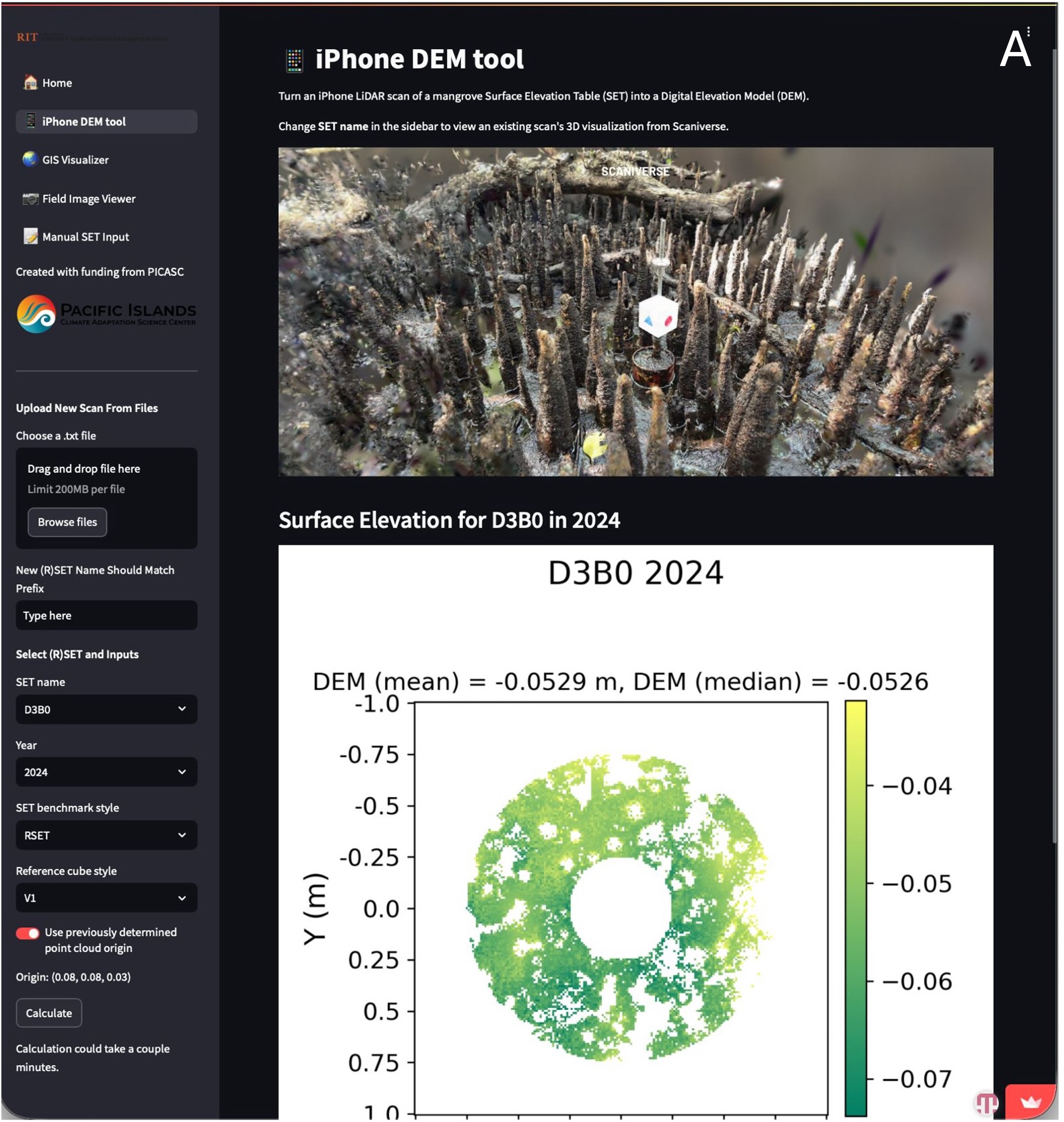
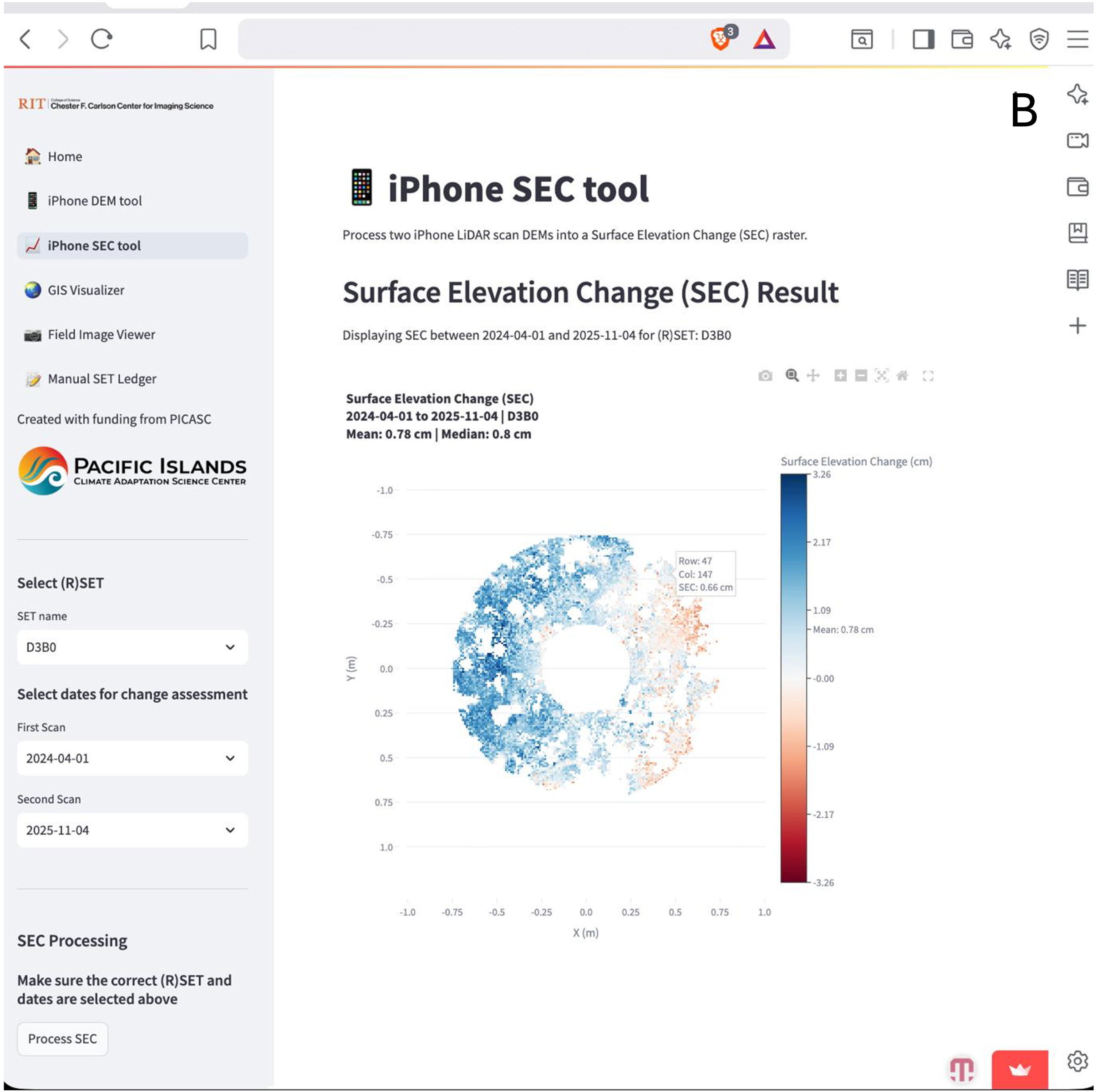
Screen shots from PACMAN web interface that shows how A. rSETs can be paired with iPhone/RTK scans and a web interface to generate rapid digital elevation models (DEMs) of plot surfaces. B. Remeasurement produces surface elevation change (SEC) maps that visualize elevation gain/loss between visits and estimate mean elevation change for a site.
Blue Roots works with island communities and agencies to expand PACMAN monitoring across the Pacific.
Contact Us